 Full screen version
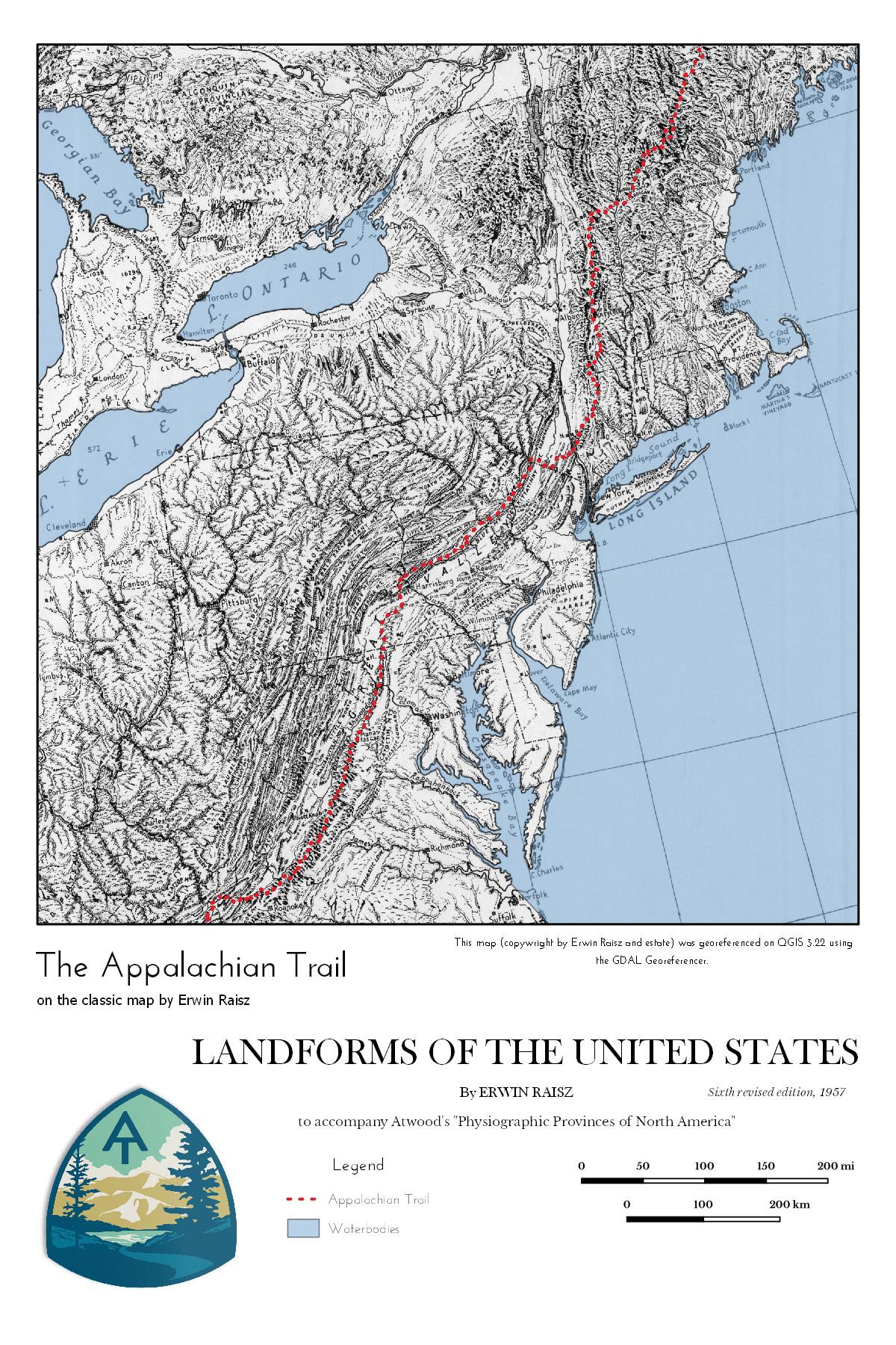
The Appalachian Trail via Erwin Raisz
Authored by: Evan Kerr
Here is a link to download the Georeferenced version of Landforms of the United States.

Views on the Appalachian Trail.
This map uses as its basemap Erwin Raisz's classic handdrawn Landforms of the United States (1957).
Georeferenced using the GDAL Georeferencer in QGIS 3.22.
University of Kentucky New Maps Plus, Fall 2021.
- Follow me on twitter @evanjkerr.
- Visit my Github account @evanjkerr.
- Here's my profile on Linkedin.